History
of Ethiopia
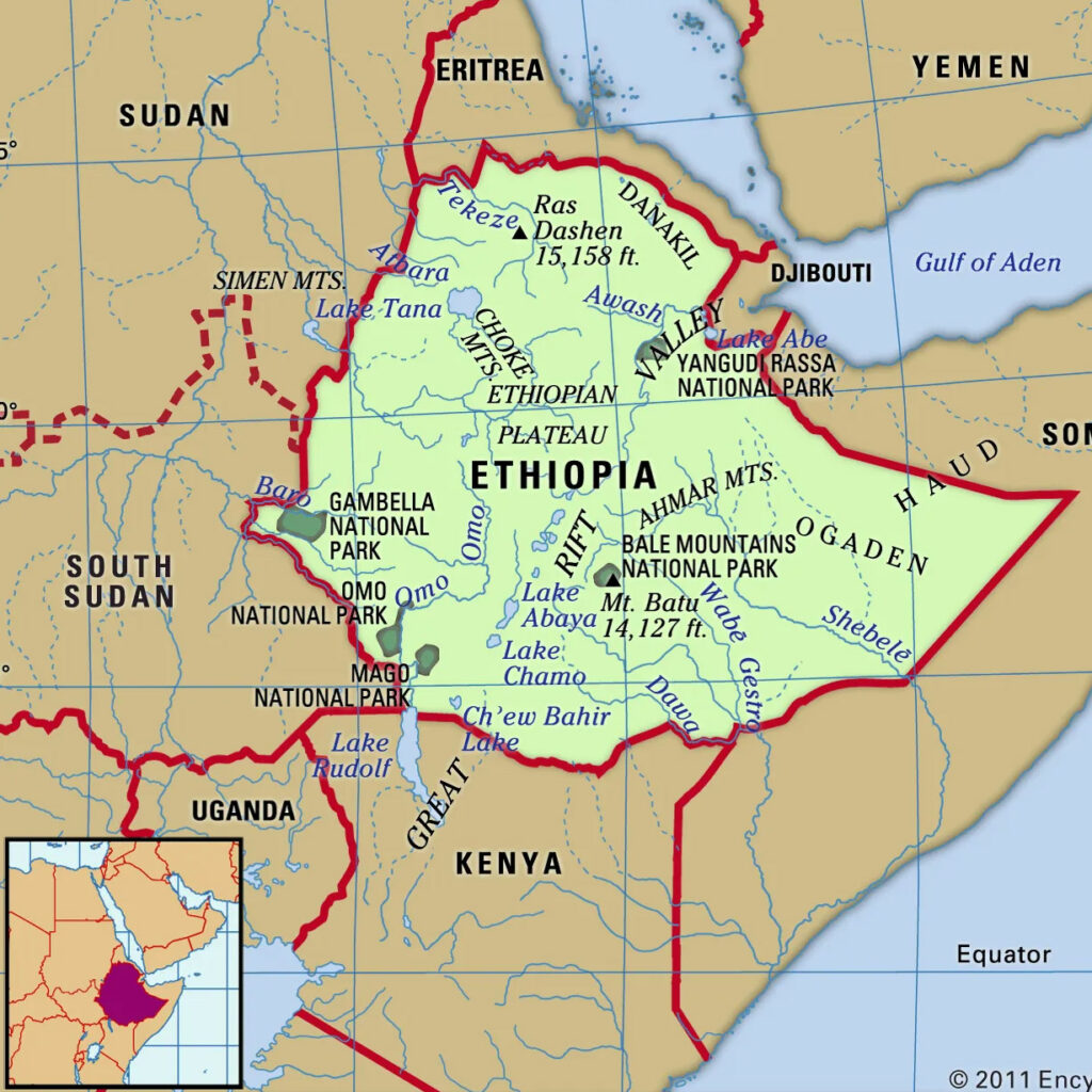
Ethiopia is bounded by Eritrea to the north, Djibouti to the northeast, Somalia to the east, Kenya to the south, and South Sudan and Sudan to the west.
Ethiopia’s topography, one of the most rugged in Africa, is built on four geologic formations. Rocks of Precambrian origin (more than 540 million years in age) form the oldest basal complex of Ethiopia, as they do in most of Africa. The Precambrian layer is buried under more recent geologic formations—except in parts of northern, western, and southern Ethiopia, where there are exposed rock layers of granite and schist. Geologic processes of the Mesozoic Era (about 250 to 65 million years ago) contributed sedimentary layers of limestone and sandstone, most of which have been either eroded or covered by volcanic rocks. Younger sedimentary layers are found in northern Ethiopia and on the floors of the Rift Valley. Lava flows from the Cenozoic Era (i.e., the past 65 million years) have formed basaltic layers that now cover two-thirds of Ethiopia’s land surface with a thickness ranging from about 1,000 feet (300 metres) to almost 10,000 feet (3,000 metres). The Rift Valley forms a spectacular graben (a massive tectonic trough) running right down the middle of the country from the northern frontier with Eritrea to the southern border with Kenya.
Ethiopia’s topography, one of the most rugged in Africa, is built on four geologic formations. Rocks of Precambrian origin (more than 540 million years in age) form the oldest basal complex of Ethiopia, as they do in most of Africa. The Precambrian layer is buried under more recent geologic formations—except in parts of northern, western, and southern Ethiopia, where there are exposed rock layers of granite and schist. Geologic processes of the Mesozoic Era (about 250 to 65 million years ago) contributed sedimentary layers of limestone and sandstone, most of which have been either eroded or covered by volcanic rocks.
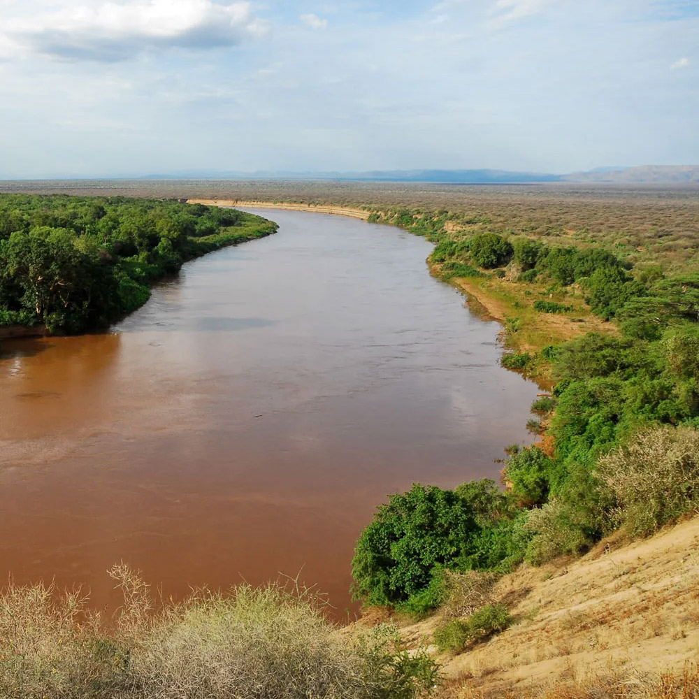
Although Ethiopia’s complex relief defies easy classification, five topographic features are discernible. These are the Western Highlands, the Western Lowlands, the Eastern Highlands, the Eastern Lowlands, and the Rift Valley. The Western Highlands are the most extensive and rugged topographic component of Ethiopia. The most spectacular portion is the North Central massifs; these form the roof of Ethiopia, with elevations ranging from 14,872 feet (4,533 metres) for Mount Ras Dejen (or Dashen), the highest point in Ethiopia, to the Blue Nile and Tekeze river channels 10,000 feet below. Lake Tana—Ethiopia’s largest inland lake and the main reservoir for the Blue Nile River—is located in this region, at an elevation of about 6,000 feet (1,800 metres).
Younger sedimentary layers are found in northern Ethiopia and on the floors of the Rift Valley. Lava flows from the Cenozoic Era (i.e., the past 65 million years) have formed basaltic layers that now cover two-thirds of Ethiopia’s land surface with a thickness ranging from about 1,000 feet (300 metres) to almost 10,000 feet (3,000 metres). The Rift Valley forms a spectacular graben (a massive tectonic trough) running right down the middle of the country from the northern frontier with Eritrea to the southern border with Kenya.